|
"a bi-monthly journal of environmental news and commentary..."
Bending the TrendBy Thera Black
 It's easy to point out how our transportation system doesn't work as we'd like it to. But as bad as it may seem at times, it really could be much worse. Here's why it isn't. It's easy to point out how our transportation system doesn't work as we'd like it to. But as bad as it may seem at times, it really could be much worse. Here's why it isn't.
- As far back as 1968 we were planning for bike lanes and bike corridors throughout the Lacey-Olympia-Tumwater urban area. Today we have over 50 miles of dedicated trails in the Thurston County region, 80 miles of on-street bike lanes, and over 260 miles of multi-use shoulders.
- This region embraced "complete streets" long before that became a popular planning idiom. Each city incorporated bike and pedestrian facilities in their street standards so that when new streets are built or existing ones retrofitted, the non-motorized network grows. Cities also earmark funds for stand-alone bike and pedestrian projects, such as Olympia's utility tax for pathways.
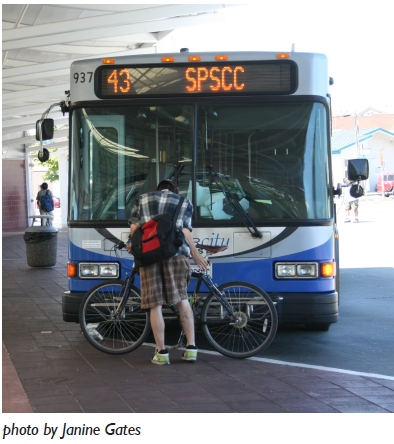
- Intercity Transit provides a level of service that belies our small population. That is due in large measure to a community that values transit and supports transit funding measures. It is also due to strategic and often difficult operational decisions about what service to run where and when. IT is incrementally building the transit system needed to serve our predominately suburban community and support the urban community envisioned in adopted plans.
- We can't build our way out of congestion and in 1998 this region adopted a policy that officially limits the mid-block width of arterials to no more than two lanes in each direction plus a center turn lane or median with appropriate bike and pedestrian facilities. This is supported by connected streets policies that ditched the cul-de-sac in favor of the old-fashioned, efficient street grid. Cities also employ 'road diets' where appropriate to reduce the number of travel lanes.
- The regional 'Smart Corridors' team is working on a pilot program to coordinate signal programs among the jurisdictions and with Intercity Transit. Using technology and regional coordination to improve mobility is often more cost effective than widening.
- Roundabouts!
- Lacey, Olympia, Tumwater, and Yelm all collect transportation impact fees, though the fees go by different names. The fees collected from development are used to leverage state grants to pay for the share of costs the rest of us are responsible for, because not all project costs are related to development in a particular city. Cities also require frontage improvements that retrofit outdated street edges to current adopted standards, further piecing together with developer contributions a seamless non-motorized system.
- Trip reduction is a big part of our transport strategy. Commute Trip Reduction efforts at the region's largest public and private employers were expanded in 2010 to include all state agencies regardless of size. At the other end of the spectrum, "Walk and Roll" programs are in place at several schools with more on the way. These programs encourage children – and their parents – to use alternatives like biking and walking to get to school.
- Land use is perhaps the most important part of this region's transportation strategy, and the most vexing. We have curbed many inefficient development patterns that characterized growth from the 1960s through the late 1990s. That's good, but we're still not realizing truly urban growth. "Complete streets" that don't serve "complete neighborhoods" with a mix of housing, jobs, and services in well-designed environments are missed opportunities at reducing auto-dependence. Strategies to encourage urban development are a critical transportation challenge, which members of the TRPC Urban Corridors Task Force are currently tackling by identifying and evaluating barriers that preclude us from achieving the kind of walkable, transit-supportive districts envisioned in our plans. -}
This list is far from complete and each bullet is too brief. But it offers a sample of measures that help to counter what should have been worse sprawl and fewer viable travel choices for a west coast community bisected by an interstate.
Decisions in the late 1950s routed I-5 through the heart of our urban area and up Tumwater's main street; over the decades highway interchanges punctuated our metropolitan area every mile or so. These are irrefutable aspects of our history that exert powerful forces on transportation and land use. Despite that, we are slowly but surely bending the trend that this history would signify.
We don't always get it right. And we have decades' worth of legacy issues with which to contend – issues that are neither cheap nor easy to address. But we have come a long way and are doing many things right. It's worth reminding ourselves of the progress we're making while we continue to address the challenges we still face.
Thera Black is a senior planner for the Thurston Regional Planning Council, and works in the areas of regional transportation and land use. Readers interested in more information about the topics mentioned in the article or other aspects of the transportation – land use picture are welcome to contact her at blackvt@trpc.org or by phone at (360) 741-2545. Readers are also encouraged to visit the TRPC website at http://www.trpc.org and explore information and on-going processes related to regional sustainability planning, transportation, land use, data, and many other topics.
Back to Home page.
|